NORTH DAKOTA STATE UNIVERSITY
- FARGO, N D


Credits: Imagery is courtesy of the U.S. Geological Survey's Land Remote Sensing Program.

|
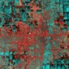
March 18, 2009: Fargo-Moorhead region prior to major flooding.
|

|
April 3, 2009: Fargo-Moorhead region during major flooding.
|

|
March 18, 2009: Southern Red River Valley region prior to major flooding. LARGE FILE: 70 MB.
|

|
April 3, 2009: Southern Red River Valley region during major flooding. LARGE FILE: 53 MB.
|

|
March 18, 2009: Fargo-Moorhead region prior to major flooding, annotated and reprocessed to more "natural" coloration.
|

|
April 3, 2009: Fargo-Moorhead region during major flooding, annotated and reprocessed to more "natural" coloration.
|

|
Animation of change at Fargo: Transition between March 18th and April 3rd Landsat images.
|

|
Animation of change north of Fargo: Transition between March 18th and April 3rd Landsat images. Gardner, ND is at extreme southwest corner of image.
|
|


