|

Making strike and dip measurements on the Thomson Formation exposed in the St. Louis River near Jay Cooke State Park.
Photo by B. Saini-Eidukat.
|

Making strike and dip measurements on the Thomson Formation exposed in the St. Louis River near Jay Cooke State Park.
Photo by B. Saini-Eidukat
|
|
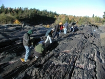
On the Thomson Formation exposed in the St. Louis River near Jay Cooke State Park.
Photo by B. Saini-Eidukat
|

Making strike and dip measurements on the Thomson Formation exposed in the St. Louis River near Jay Cooke State Park.
Photo by B. Saini-Eidukat
|
|

View of the Thomson Formation exposed in the St. Louis River
Photo by Justin Costa Rica
|

View of Duluth from Skyline Parkway
Photo by Justin Costa Rica
|
|

Thinly layered sediments at the Grandview stop
Photo by Justin Costa Rica
|

Sediments at Good Harbor Bay
Photo by Justin Costa Rica
|
|

Skeletal olivine crystals in the Beaver Bay body
Photo by Justin Costa Rica
|

Gooseberry Falls
Photo by Justin Costa Rica
|
|

Gooseberry Falls
Photo by Justin Costa Rica
|

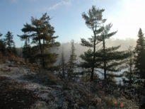
End of the Trail campground, Gunflint Trail
Photo by Justin Costa Rica
|
|

Around the campfire
Photo by Justin Costa Rica
|
Around the campfire
Photo by Justin Costa Rica
|
|
End of the Trail Campground, Gunflint Trail
Photo by B. Saini-Eidukat
|
|


