 Home Home
 Image Map Image Map
 Search Search
 References References
 Links Links |
|

Falkland
Islands: 51°
00' - 52° 30' S, 57° 40' - 61° 30' W
- Area:
13,000 km².
- Physical Features:
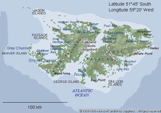
The group comprises the main islands of East Falkland and West
Falkalnd, with about 340 associated islands and islets.
- Highest elevation
- 705 m Mt. Usborne on East Falkland Island.
- The islands are composed
of Paleozoic and Mesozoic sediments, with considerable folding.
The oldest rocks are Pre-Cambrian, about 2.5 billion years old.
- Generally rugged
and hilly. Several small rivers occur. Peaty soils
are widespread, with stony, gravel soils at high elevations.
- Climate is oceanic:
strong prevailing westerly winds, high humidity, low rainfall,
cloudy, frequent snow (but no permanent ice), mean annual temperature
5 - 6° C.
- Historical features:
The islands are thought to have been discovered in 1592 by an
English Captian, John Davis. The first recorded landing
was in 1690, by Captain John Strong, who named the islands after
Viscount Falkland, then Treasurer of the British navy.
- In 1982, hostilities
occurred between the United Kingdom and Argentina over sovereignty
of the islands. Sovereignty is claimed by both the United
Kingdom and Argentina.
- Biological links:
- Royal Botanic Gardens, Kew, - plant community information http://dps.plants.ox.ac.uk/bol/falklands
|