Effect of Flow Path Processes on Groundwater Geochemistry in a Dune-Prairie-Wetland Transect in Southeast North Dakota

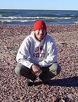
William Lenarz is a M.S. (Geology) student at the University of North Dakota in Grand Forks, North Dakota. William graduated with his B.S. degree in Geology from Iowa State University in May 2003. During his time at ISU he developed an interest in hydrogeology, which eventually lead him to pursue his graduate degree in geology, with a specialization in hydrogeology, at UND. His general research interests include groundwater and surface-water interactions, hydro-geochemistry, and artificial recharge of aquifers. For his Master’s Degree he is focusing on a project combining groundwater/surface-water interaction and hydrogeochemistry.
Email: William.lenarz@und.nodak.edu
Fellow: William Lenarz, Geology and Geological Engineering Department, UND
Advisor: Dr. Philip J. Gerla Associate Professor of Geology, University of North Dakota
Committee Members: Dr. Scott Korom and Dr. Richard Josephs
Degree Progress: M.S. in Geology expected May 2007
Effect of Flow Path Processes on Groundwater Geochemistry in a Dune-Prairie-Wetland Transect in Southeast North Dakota
Project Background:
The large seepage face at Pigeon Point, Ransom County, North Dakota, provides an opportunity to trace the evolution of groundwater geochemistry back to its source as infiltrating precipitation. Previous work delineated pathlines and the capture zone in the groundwater flow system, which extends several kilometers upgradient. The contrasting land cover within the spring and seep capture zone consists of dunes, native grass pasture, wetland, and irrigated cropland that lie above the phreatic Sheyenne delta aquifer. Previous work revealed that the seepage face shows a wide variation in mineralization and oxidation-reduction conditions, with strikingly more reduced and mineralized water discharging from higher areas indicating a shorter groundwater pathline. We hypothesize that the groundwater quality relates to vadose and shallow phreatic geochemical processes, which are largely controlled by differences in soils and land cover, and that water composition remains generally unchanged along deeper pathlines.
Project Objectives:
- Install monitoring/sampling equipment along a groundwater pathline.
- Select six springs to sample to represent best the varied water quality found within the discharge zone.
- Collect samples of water during different seasons (Fall, Spring, and Summer) to determine if groundwater quality and chemical transport vary temporally across the study area. Seasonal samples will reveal how dissolved constituents in groundwater change during different times of the year.
- Sample and analyze pH, conductivity, and dissolved oxygen in the field.
- Analyze major anions, cations, and total and organic carbon content at UND's Environmental Analytical Research Laboratory using flame atomic absorption spectrometry (FAAS), total organic carbon analysis (TOC), and ion chromatography (IC).
- In conjunction with soil water and groundwater sampling and analysis, work to better understand the physical conditions of infiltration and recharge will be completed during the project. At and near the instrumentation sites, matric potential, moisture content, and soil permeability will be estimated using transducer tensiometers, portable time-domain reflectometry surveys, and a disk infiltrometer. These data will be used to create basic numerical models of infiltration and recharge using the USDA Salinity Laboratory's HYDRUS-2D code.
Progress to Date:
Installation of the monitoring/sampling stations along the selected groundwater flow pathline has been completed. Further site development was conducted to ensure successful water collection during the first and subsequent sampling events. Last October the first set of samples were collected and analyzed. The second set of samples were also collected and analyzed this past May. The final set of samples will be collected in July. In addition to sample collection and analysis, thesis writing has also begun.
Results:
Upon initial observations and comparisons of the results from the two sample collections, our initial hypothesis is holding true. The springs that are discharging at higher elevations (indicating shorter travel times and pathlines) are producing results indicating a much more reduced environment. The springs that are discharging at lower elevations (indicating longer travel times and longer pathlines) on the other hand are producing results indicating higher levels of oxidation. The common processes would lead to the idea that groundwater traveling over a shorter distance and shorter time span should discharge with a higher level of oxidation, while the groundwater traveling over the longer distance and taking more time should discharge more reduced. As our first two sample collections are indicating, the spring and fens at Pigeon Point are unique in that the groundwater discharging is reversed from what would commonly be expected.
Significance:
Although the variation of geochemical composition of groundwater on a regional basis is generally understood, much less is known about the detailed, local processes that lead to the spatial variation of groundwater chemistry along a flowline. The groundwater flow system at Pigeon Point is well constrained physically, and shows remarkable variation across the seepage face. Results will provide a conceptual model on how groundwater composition evolves within this shallow aquifer flow system. The model will be used to explain the unusual variation of water quality at the seepage face and help predict changes in water quality following alteration of land cover. The groundwater flow system maintains wetlands that host rare and unusual flora found only in boreal region hundreds of kilometers to the northeast. The north-facing slope, shaded by some of the only remaining old-growth riparian forest in North Dakota, creates a unique environment where continuously moist and cool hardwood forest borders an extensive xeric plant community developed in nearby dunes. This valuable natural resource exhibiting an unusually large biodiversity, however, is threatened by the growing demand for fresh water in the region. The Sheyenne delta aquifer constitutes an important source of high quality groundwater in southeast North Dakota and may provide water for Fargo in the future.

Phil Gerla
Geology & Geological
Office: Leonard Hall Room 2013
81 Cornell Street Stop 8358
Grand Forks, ND 58202-8358
Telephone: 701-777-3305
Email: philip.gerla@UND.edu


